 |
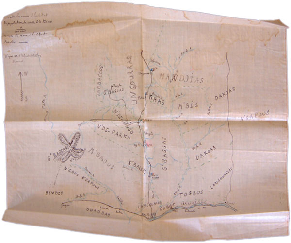
'Carte des zones d'habitat des populations du Cercle de la Kémo'
Map of tribal areas around the Kemo River, Oubangui-Chari, with 'habitat' boundaries marked in green and French colonial routes, linked by military posts, shown in black.
Pitt Rivers Museum, Manuscript Collections, Hottot Papers 1/2g
|
Source: Philip N. Grover and Christopher Morton, Congo Journey: Photographs and Documents from Robert Hottot's Expedition to Central Africa, 1908-9 [website], (published online September 2005, last updated 8 February 2006) <http://www.prm.ox.ac.uk/congojourney>.
|