 |
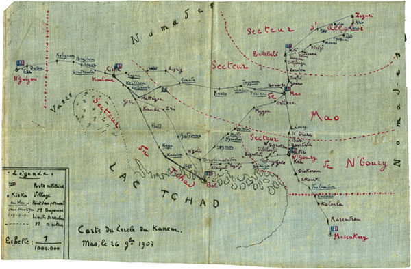
'Carte du Cercle du Kanem'
Map of the Kanem region north-east of Lake Chad, drawn by Robert Hottot at Mao on 26 November 1908 (misdated 1907).
Pitt Rivers Museum, Manuscript Collections, Hottot Papers 1/2n
|
Source: Philip N. Grover and Christopher Morton, Congo Journey: Photographs and Documents from Robert Hottot's Expedition to Central Africa, 1908-9 [website], (published online September 2005, last updated 8 February 2006) <http://www.prm.ox.ac.uk/congojourney>.
|